My first wake-up next to the sea wasn't nice at all. Everything was grey and foggy and temperatures had dropped to almost 13℃ at night - Californian summer!:) At least it was super dry and no sign of moisture anywhere, although the fog was all around.
When I reached the next tiny village at the beginning of the cliff-coast section called Ragged Point I ordered, for first time on this trip, a hot chocolate instead of a cold soft-drink:) The guy in the shop told me that it usually stayes that foggy most of the day and can clear up very rarely in the late afternoon. He also told me that they get this fog and the low temperatures every year the whole time between June and the end of August when it always clears up suddenly and you get super warm summer weather for a couple of weeks. That was so hard to believe that this place with not even 17℃/62℉ in the highs should get 35℃/95℉ not even two weeks from now! Now I really had to find out what was wrong about this weather here and looked it up while enjoying my very hot chocolate:)
It's actually quite simple: All the weather here is influenced by the very cold California-stream which flows from the north to the south right next to the coast. This stream never exceeds 15℃/60℉ in the summer and cools down the warm and humid air coming from the tropical sea which causes all the fog right in front of the coast. This effect is reinforced by the warm air rising above the land "pulling" the air from the sea towards the coast. The fog is hold back then by the coastal mountains and once it gets inland it simply dissolves above the heated ground. This effect causes this miserable but dry, foggy weather at the coast, while just a few miles inland you can swim in your pool when it's too hot for anything else. But at the end of August the inland starts to cool down, the "pulling" of the raising air becomes less and the fog stays away from the coast which changes the coastal weather from grey and cold to hot and sunny within just a couple of days. The result of this is that right at the coast the warmest months of the year are September and October instead of July and August like everywhere else. Actually that was exactly what expected before but it really surprised me that this phenomenon becomes so extreme here that you're barely able to see the sun for two months!
 |
| Rough campsite above the street this time |
 |
| Starting in foggy weather the very first time |
 |
| It's summer, yes! |
 |
| It's so summer!:) |
But now my route was already planned and although I would have liked some sunshine while cycling along the coast the temperatures in the afternoon were actually quite comfortable for cycling, without the wind, not too cold. At least you could see the cliffs a couple hundred meters out of the water till they disappeared in the fog which still looked pretty impressive and probably even more rough and wild than in sunshine.
Besides of the weather I had another wrong expectation of the Californian coast. On the map you would guess that now after all the mountain cycling the flat and comfortable part begins cause the coast as most people know is flat, right?
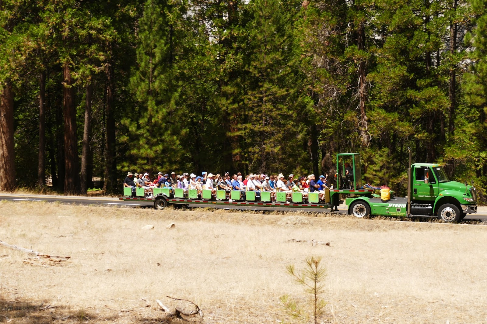
Well...I would say "flat" and "comfortable" are not the words I would choose for describing the part of Highway 1 between Paso Robles and Big Sur. "What the hell?", "Why?" and "Are you kidding?" fit way better! The guys who planned that road somehow thought it might be funny to make it least flat as possible. In fact the road is going up for maybe 200m/680ft and down to sea level again just to go up another time continuing like this the whole time! Maybe they wanted to build a roller coaster but then changed their mind? Whatever the reason was, it lead to the day with the second most meters in altitude after the Yosemite-climb, 1981m uphill in one day, at the coast!! However the temperatures were alright and I made quite good distance (as much as possible on this road) till I reached the little pass (300m) before Big Sur.
Suddenly I spotted a whale down in the ocean, I don't know which kind but definitely really big, what a surprise! Whale-watching for free:) Now that I was very close to Big Sur the traffic on the street changed totally. Most of the cars were either firefighters or policeman now and not many tourists anymore. A few kilometers later then I could see the fire by myself: It was coming down the mountain ridge right on the other side of the valley, not even 1km/0,6mi away from the street! Literally the whole side of the valley was burning, really scary, and I could imagine quite well why they would probably close the road very soon and evacuated the whole valley. At the next gas-station they had plenty of info-material about the fire and a few maps were you could see the proceeding of it during the last 20 days. The cause apparently was an illegal campfire located 15 km north of Big Sur which turned now into a massive bush-fire, burning more than 70000acres/280km^2 so far! Luckily the smoke has been blowing inland this day so I couldn't smell anything.
To find a place to sleep that night I had to cycle even 20 km further because they were about to close the whole section of the road around the fire during the night which meant nobody was allowed to stay inside this section between 10pm and 6am the next day but I made it out easily so I didn't have to care about his anymore:)
 |
| Super flat coastal-road |
 |
| Sooooo flat! :) |
 |
| Guess in the sunshine these colors would look amazing! |
 |
| Abnormal flat part of the road:) |
 |
| Deep blue ocean water (yes I used a filter:) |
 |
| Whalewatching for free:) |
 |
| Endless wild coast... |
 |
| The Soberanes Fire coming down the mountain |
 |
| A map of the current situation: The red areas are the ones which are currently burning. the more green it becomes the cooler it is. The red dot is me. |
The next day I intended to get to Santa Cruz where I intended to meet Jodi and her family. This time there is not much to tell about the cycling during the day cause nothing special (except of my hot chocolate in the morning) happened. After just 20km/12mi the steep coast sections gave way to the wide Salinas Valley, I had to cross before reaching Santa Cruz at the other end. One interesting fact might be that Salinas Valley is also known as "The Salad Bowl Of The World" cause here almost 80% of the whole salad in the US is growing! But that was really it. The sky was grey, not much nature, all flat and so I could cycle pretty fast and reached Jodi's home already by 4:30pm in Santa Cruz. She, her husband Jesse and her two kids are living in a really nice house and neighborhood not far from the sea.
And again I got such a nice welcome! After taking a shower Jodi made a whole bowl full of enchiladas, filled with chicken, cheese and other delicious things I didn't ask about:) It was sooo good! During the evening we had lots of talks and she told me that she got some friends in San Francisco I really have to meet so I wrote down their contact cause I really liked the idea of staying at someones house there way more than staying in a random (and expensive) hostel.
Before I left the next morning Jodi made me a whole bag with sandwiches, snacks and candy which I totally enjoyed, everything (especially the sandwiches) was really delicious, thanks so much for everything, really! I felt kinda sad that I didn't stay at their home longer but now I was really focused on getting to San Francisco in time so I decided not to risk being in a rush at the very end and went on. After a couple of hours along the coast something crazy happened: The sun came out! Yeah, unbelievable! I got two hours of pure sunshine, soooo crazy! (If you can't believe it either, watch the photos:) Unfortunately after two hours the fun was over and fog started to come in again near Half Moon Bay. This was also the spot where I finally had to turn right, otherwise I would have ended 20km/12mi further in a city called San Francisco which I promised myself not to cycle into before I would have reached the 10000km-mark. Current standing: 9480km/5890mi so I had to do a northern loop around the bay and back south on Highway 1 to gain the missing 520km/323mi. With 6 more days to go, no problem! I turned right then and cycled over a tiny pass to the other side of the coastal hills into the San Francisco Bay Area, where I immediately, after crossing the pass summit, got my sunshine back. Even these tiny hills were able to hold the fog back and save the Bay sunshine while people in Half Moon Bay have to freeze. Cause I didn't want to cycle the whole way around the southern end of the bay I planned on taking one of these giant bridges across to get to the other side. Unfortunately the San Mateo Bridge which started right were I entered the bay wasn't open for cyclists so I had to take Dumbarton Bridge 20km/12mi south of San Mateo. Right next to this bridge I spotted the Google Headquarters on the map, just a 10km detour and because it actually didn't matter how I would get my kilometers done I decided to take a look.
Somehow Google Maps guided me through the very middle of Stanford University which was somehow exactly between me and Google:)
Wow! This university is really nice! Palms, flowers and green stuff everywhere between these nice designed buildings with their tiled roofs. I would definitely love to study here but I'm probably to dumb and to poor for that:/ Cause I took so many photos there it was already getting dark and I planned on cycling to Google the next morning and tried to find a place to sleep now which turned out to be quite difficult cause the Bay Area is actually a single giant city with not too much wilderness but I found something then when I headed a little bit back towards the hills.
 |
| My campsite under a giant tree |
 |
| Pig crossing ahead:) |
 |
| Deer walking through the streets of Pacific Grove |
 |
| Jodi's home in Santa Cruz |
 |
| The whole family:) |
 |
| Cute kitty they have:) |
 |
| Mmmmh...yummy!:) |
 |
| Carzy, sunshine! |
 |
| Wild coast sections just 30km/19mi before San Francisco |
 |
| Second Whale-watching for free:) |
 |
| Fog flowing over the hills and dissolving in the bay. |
 |
| Stanford University Main Entrance |
 |
| Inside the Campus |
The Googleplex was huge! I'm not sure how many buildings they've got but definitely more than 50! Unfortunately there's not much to see if you're not going inside but the main buildings are surprisingly small for such a huge company! Nevertheless it was interesting to see but I didn't stay too long there and went over Dumbarton Bridge soon after. Although this is one of the shorter bridges of the bay it took me more than half an hour to cross it which was definitely the longest bridge ride I ever did. Same time as my arrival on the other side the sun came out and the wind as well. It was blowing quite strong directly from the sea so the direction didn't bothered me too much but it made me feel quite cold during the day although the sun was shining. From Dumbarton Bridge I cycled the whole way on bike-paths through the eastern bay area which includes the cities of San Lorenzo, San Leandro, Alameda, Oakland, Berkeley, Albany and Richmond. Actually I never knew when I left one city and entered another (if viewed from space everything looks like one big city!) Most of the time the bike-paths kept me away from the water but one time I couldn't resist on taking a look of where I would end and I could see it very clear across the bay: the beautiful city of San Francisco. It was so close, just one hour to cycle but for now it was just watching, no touching!:/ The more I cycled away from the open sea now the warmer it became again and by sunset I got the highest temperature of the day with 24°C/75°F which is the perfect temperature for cycling in my opinion. Right before Carquinez Bridge at the northeastern end of the bay I pitched my tent before entering the city of Vallejo on the other side where it would have been probably hard to find a place to camp. During this evening I recognized that I might had caught a cold during the last couple of days which was actually not that much a surprise after this cool-down but it became really bad during the night. I definitely had fever and just could hope that it would be a little bit better the next morning cause getting really sick so close to the end would have been horrible!
The next morning it was slightly better. The fever was apparently gone but I still felt really sick so I decided to give it up and take the train to San Francisco.
 |
| Camping near Stanford |
 |
| Under this tree:) |
 |
| Google Headquarters |
 |
| Google bikes everywhere |
 |
| Approaching Dumbarton Bridge |
 |
| Canals somewhere near Oakland |
 |
| There it is: San Francisco on the other side of the bay |
 |
| The very top of Golden Gate Bridge sticking out of the fog. |
I'm kidding:D Never ever would I have taken the train after cycling 9600km/5970mi so far unless I would have broken both legs or gotten an illness I couldn't have walked with anymore. So I just started a little slower than usual and got myself another hot chocolate which really helped my throat which hurt really bad this morning. Then around 10am I got another call from SWR3 which was funny because that wasn't the night show this time, it was 7pm in Germany. Another host of the evening-show said hello and I remembered how that could have happened. The day before they were doing a quiz in the radio where people from all over the world could sent hints of the place they're staying in the moment to SWR3 and people listening can guess which place/city that would be. I sent a couple of hints for San Francisco and why I'm here but nothing happened so I expected nothing else to happen anymore because usually he doesn't call people for a quiz. I guess he didn't know that I was talking several times a week with the other host cause he sounded quite surprised by my story and did a short interview with me. The funny thing was that this wasn't live but I didn't know that he was recording so I just talked like during a normal phone call. One hour later after somebody solved the quiz he played exactly this talk we had before, pretending it to be a live interview. For somebody who didn't know it was really quite hard to realize that this wasn't live.
I was just interested who the other host I was talking to usually would say. If he would feel cheated?:D
My plan for the next four days was perfect: Exactly after two days I should reach the coast again and then the remaining distance on Highway 1 should be perfect for two comfortable final days:) Now that I was cycling approximately 30-40km apart from the coast the summer was back and the temperatures hit 36°C/97°F again. I was cycling through Napa Valley that day, apparently famous for its wine according to the hundreds of vineyards I passed. One thing I still haven't found out about this valley was where all these limousines were coming from. Dozens of 7-8m long limousines passed me during the day and my only explanation was that this wine must be insanely good, cause even in Vegas I saw less of them!:)
Cause I still felt a little bit weak from my cold I was super happy then when I heard out of the sudden this BOOM-sound and stood completely still the next moment. At least it was no tire-wire this time cause the only thing I found was a big hole where something really big and sharp must have hit my tire. Probably a piece of a wine bottle, one of these rich guys had thrown out of his limousine (just an assumption:) So I could change my tube in the sunshine and enjoying the heat what my body at this moment really didn't like!
But I guess I should see this positive: Nothing really bad happened, I was feeling better and I could cycle the rest of the day over a little hill into the next valley (Alexander Valley) where I stayed the following night close to a little town called Geyserville.
 |
| Campsite near Carquinez |
 |
| Looks pretty familiar:/ |
 |
| :/ |
 |
| Camping in the woods close to Geyserville. |
 |
| My way from San Simeon to Geyserville |